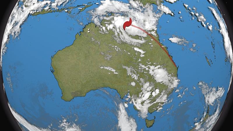
Tropical Cyclone Owen is likely to cause flooding in northern Queensland through this weekend after doing an about-face near northern Australia earlier this week.
Early news from the western York peninsula is good as Owen’s core missed the small population center’s on the coast, but heavy rain could still be a problem further south and east.
Residents and authorities in far north Queensland are preparing for Owen’s arrival.
Extra police and paramedics have been put in place along the forecast path, according to the Cairns Post. Roughly 100 homes have been evacuated to get residents into more sturdy structures.
Owen’s origins track all the way back into the first few days of December, when it developed from an area of low pressure in the Coral Sea east of Australia. Owen moved west, crossing northern Queensland Dec. 10 with heavy rain and gusty winds.
Owen then regenerated over the Gulf of Carpentaria.
A change in upper level winds forced Owen to make a U-turn and it’s now virtually double-backing over its previous track across northern Queensland.
In this case, a tropical cyclone is the generic term used by Australia’s Bureau of Meteorology (BOM) to describe both tropical-storm- and hurricane-strength systems.
The BOM and the American National Hurricane Center (NHC) also use different scales to describe tropical systems. We’ll be using the American Saffir-Simpson Hurricane Wind Scale used by the NHC.
Owen made landfall between Kowanyama and the Gilbert River Mouth early Saturday morning, local time, as a low-end Category 1 equivalent tropical cyclone using the Saffir-Simpson Hurricane Wind Scale, according to the BOM. (Queensland is 15 hours ahead of U.S. Eastern standard time.)
Owen has already brought tropical storm-force winds to the Pellew Islands in the southwestern Gulf of Carpentaria.


